|

 Save time and money by using our booking service.
more details
|
|
|

|
|


|
|
Useful for Walkers
|
|
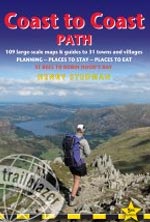
Coast to Coast Path, 5th edition
|
by Henry Steadman
Published:
2012
Binding: Paperback, 256 Pages
Dimensions: 180 mm x 120 mm
Weight:
250 grams
|
RRP:
�11.99

|
| |
 You could pick this book up and never use another resource from the first stages of planning to arriving in St. Bees.
- Stuart Greig
The most complete guide: with all the detail you`ll need for a walk in Wainwright`s footsteps.
- The Sunday Times
We were very impressed by your guidebook & I used it not only for the walk but also for booking B&Bs etc.
- Jane Johnson
An outstandingly good value and very useful guide.
- Nichola Hele
Just like the Hadrian`s Wall guide which we used a couple of years ago, it has been a huge help in both planning and doing the walk and really added to our enjoyment.
- David Bull
The Coast to Coast Path runs for nearly 200 miles (320km) from St Bees on the Irish Sea across the width of Northern England to the North Sea at Robin Hood`s Bay.
This spectacular two-week walk crosses three National Parks � the Lake District, the Yorkshire Dales and the North Yorkshire Moors.
The guidebook contains all the information you need. The hard work has been done for you so you can plan your trip from home without the usual pile of books, maps and guides.
- 4th edition of this popular guidebook - all information has been checked and updated.
- Unique mapping features � walking times, directions, tricky junctions, places to stay, places to eat, points of interest. These are not general-purpose maps but detailed route guides drawn by walkers for walkers.
- Includes 109 walking maps: the largest-scale maps available � At just under 1:20,000 (8cm or 3-1/8 inches to 1 mile) these are bigger than even the most detailed walking maps currently available.
- Itineraries for all walkers � whether hiking the entire route over two weeks, or sampling the highlights on day walks or short breaks.
- Downloadable GPS waypoints.
- Practical information for all budgets � what to see, where to stay, where to eat: B&Bs, hotels, campsites, bunkhouses, hostels, pubs.
- Detailed public transport information - for all access points.
- Includes 31 town and village guides - where to stay, where to eat, transport information
NEW for the 5th edition:
- Profile maps - show the gradients for each stage to help plan the walk
- More colour - extra 16 pages of full colour at the front to help you find information quickly and easily
- High and low level routes - gives you detailed options to consider depending on fitness level and weather
- Completely rewalked and all information rechecked
Features
- 117 maps�8 town plans and 109 large-scale walking maps � at just under 1:20,000 � showing route times, gradients, where to stay, interesting features; includes GPS waypoints
- Itineraries for all walkers � whether walking the route in its entirety over two weeks or sampling the highlights on daywalks and short breaks
- Practical information for all budgets � Where to stay (campsites, hostels, B&Bs, pubs and hotels), where to eat, what to see
- Comprehensive public transport information for day walks� all access points on the path
- Henry Stedman is the author of bestselling Trailblazer guides to Kilimanjaro and Hadrian�s Wall Path
Back to the Books Page |
to top of the Page
|
|

