|

 Save time and money by using our booking service.
more details
|
|
|

|
|


|
|
Useful for Walkers
|
|
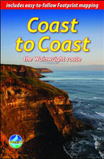
Coast to Coast: the Wainwright route
|
by Sandra Bardwell
Published:
March 2010
Binding: Paperback, 112 Pages
Dimensions: 220 mm x 145 mm
Weight:
125 grams
|
RRP:
�12.50

|
| |
 This challenging walk of 184 miles (296 km) crosses the north of England from St Bees on the Cumbria coast to Robin Hood�s Bay on the North Sea. It passes through three National Parks � the Lake District, Yorkshire Dales and North York Moors � with splendidly varied scenery. Many walkers complete it within 12 to 16 days, although some divide it into two separate week-long walks.
Devised by the legendary Alfred Wainwright, the Coast to Coast is justly famous as England's most popular walk. It is waymarked, has plenty of accommodation and features welcoming pubs. Both its ends and midpoints (Kirkby Stephen and Richmond) are accessible by public transport.
Because this route is about double the length of our normal "week-long" routes, the book's format differs from previous Rucksack Readers. It has 112 pages, 28 of them carrying mapping, and weighs about 280g/10 oz. It contains all that a walker needs :
- concise, up-to-date directions and 115 colour photographs
- 28 pages of easy-to-follow Footprint mapping (1:50,000)
- altitude profiles for each section
- background on geology, history and wildlife
- contact details for accommodation and transport
- features on St Bees, Richmond and Robin Hood�s Bay
- waterproof, rucksack-friendly format.
Back to the Books Page |
to top of the Page
|
|