Dales Highway Guidebooks and Maps
Baggage Moving Service Accommodation booking service Sherpa Van Home Choose which trail you want to follow Sherpa Van Home Sherpa Van Shop Sherpa Van Message Board Contact us About the Sherpa Van Project
Click Here for Coast to Coast GuideBooks Click Here for Coast to Coast Maps Books and videos  relating to the Coast to Coast Global Positioning Systems
 
A Dales High Way: Route Guide
by Tony & Chris Grogan
Published: September 2008
Binding: Paperback w/PVC wallet, 56 Pages
Dimensions: 210 mm x 100 mm
Weight: 100 grams
Price: �6.99
Purchase our recommended Dales Highway walking maps and guides at Amazon.co.uk
 
Back to the Books Page 
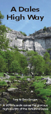
An exhilarating 90 miles across the glorious high country of the Yorkshire Dales.

Walk this spectacular landscape from Saltaire to Appleby-in-Westmorland

Explore its rich history, geology and culture

Return with a breathtaking train ride along England's most beautiful railway

This is the original guide to the new long distance walk covering 90 miles from Saltaire, near Shipley, West Yorkshire, to Appleby-in-Westmorland in Cumbria.

The guide is specially designed for use as the primary route guide for the walk, being robust, pocket-sized and with detailed route maps carrying instructions ON the maps themselves. Of course, the appropriate OS maps and a compass should also be carried.

Each copy of A Dales High Way book comes with a handy weather-resistant plastic wallet.

Back to the Books Page | to top of the Page

Home  Baggage Service   Accommodation Booking  Trail Planning   Useful Links   Book Store   About Us

E-Mail: [email protected]


Copyright � The Sherpa Van Project, 29 The Green, Richmond, North Yorkshire DL10 4RG. Tel 0871 5200124 Fax (44) 01748 825561