START HERE
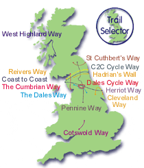
Browse Trails
BAGGAGE SERVICE

SHERPA SHOPPING


QUICK TRAIL GUIDES
|
| |||||||||||||||||||||||||||||||||||||||||||||||||||||||||||||||||||||||||||||||||||||||||||||||||||||||||||||||||||||||||||
|
[
OS Outdoor Leisure Maps ]
[
OS Explorer Maps ] [
OS Landranger Series ]
Britain is mapped with a precision not yet achieved by many countries anywhere else in the world. We offer a choice of Ordnance Survey Outdoor Leisure, Explorer and Landranger series maps to help keep you on course.
| |||||||||||||||||||||||||||||||||||||||||||||||||||||||||||||||||||||||||||||||||||||||||||||||||||||||||||||||||||||||||||
|
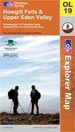
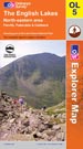
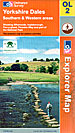
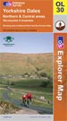
Ordnance Survey Explorer Maps
| |||||||||||||||||||||||||||||||||||||||||||||||||||||||||||||||||||||||||||||||||||||||||||||||||||||||||||||||||||||||||||
|
Scale 1:25,000; 4cm to 1km; 2ďż˝ inches to 1 mile
This scale provides detail for the really committed navigator and map enthusiast. Studying the country down to its every wall and ditch gives real confidence in route finding and satisfaction in "reading" the landscape.
Paper - they fold well, and are backed with a reasonably durable laminated cover. They will remain intact, depending on how much wind and rain you have encountered!
Lam-Fold - extra strong lamination with a 'china-graph' write-on, wipe-off surface they are also tear resistant and waterproof.
| |||||||||||||||||||||||||||||||||||||||||||||||||||||||||||||||||||||||||||||||||||||||||||||||||||||||||||||||||||||||||||