This scale provides detail for the really committed navigator and map enthusiast. Studying the country down to its every wall and ditch gives real confidence in route finding and satisfaction in "reading" the landscape.
| |
|
These maps are available in two editions:
Paper - they fold well, and are backed with a reasonably durable laminated cover. They will remain intact, depending on how much wind and rain you have encountered!
Lam-Fold - extra strong lamination with a 'china-graph' write-on, wipe-off surface they are also tear resistant and waterproof.
|
| |
|
Suggestions
|

|
|
Our suggestion is to take along the OS Outdoor Leisure strip maps for simple route-finding but take along either the Explorer or Landranger series maps for detailed route finding or to spread out while you're having your picnic or savouring a view.
|
|
|
| |
| |
|
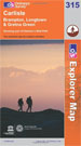
Map 315: Carlisle, Brampton, Longtown & Gretna Green
|
click to enlarge
|
1:25,000; 2.5 inches to 1 mile; 4cm to 1km
Dimensions: 225 mm x 135 mm
|
|
|
|
|
|
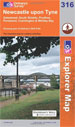
Map 316: Newcastle upon Tyne
|
click to enlarge
|
1:25,000; 2.5 inches to 1 mile; 4cm to 1km
Dimensions: 225 mm x 135 mm
|
|
|
|
|
|
Suggestions
|
|
|
Our suggestion is to take along the OS Outdoor Leisure strip maps for simple route-finding but take along either the Explorer or Landranger series maps for detailed route finding or to spread out while you're having your picnic or savouring a view.
|
|
|
| |
Ordnance Survey Landranger Maps

|
|
Scale 1:50,000; 2cm to 1km; 1� inches to 1 mile
|
| |
| |
|
These maps are available in two editions:
Paper - they fold well, and are backed with a reasonably durable laminated cover. They will remain intact, depending on how much wind and rain you have encountered!
Lam-Fold - extra strong lamination with a 'china-graph' write-on, wipe-off surface they are also tear resistant and waterproof.
|
| |
|
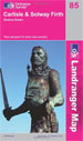
Map 85: Carlisle & Solway Firth, Gretna Green
|
click to enlarge
|
1:50,000; 2cm to 1km; 1.25 inches to 1 mile
Dimensions: 225 mm x 135 mm
|
|
|
|
|
|
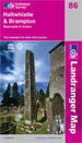
Map 86: Haltwhistle & Brampton, Bewcastle & Alston
|
click to enlarge
|
1:50,000; 2cm to 1km; 1.25 inches to 1 mile
Dimensions: 225 mm x 135 mm
|
|
|
|
|
|
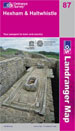
Map 87: Hexham & Haltwhistle
|
click to enlarge
|
1:50,000; 2cm to 1km; 1.25 inches to 1 mile
Dimensions: 225 mm x 135 mm
|
|
|
|
|
|
Map 88: Newcastle upon Tyne, Durham & Sunderland
|

click to enlarge
|
1:50,000; 2cm to 1km; 1.25 inches to 1 mile
Dimensions: 225 mm x 135 mm
|
|
|
|
|
|
|
| |
| |